0 SUMMIT LEVEL RD
RAILROAD FLAT, CA 95248
$1,090,000
N/A Acres
A1-General Ag Zone
Status Active
MLS# 202300706
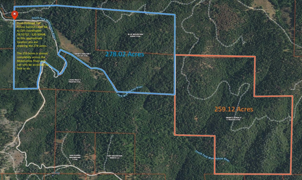
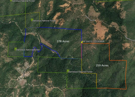
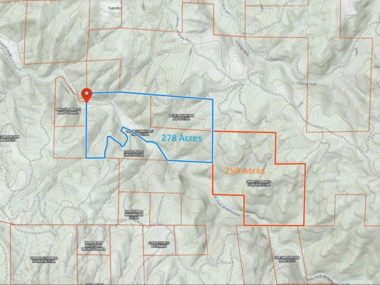
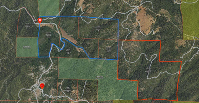
Looking for REALLY remote acreage? This 537 acre listing is made up of 14 separate parcels that the South Fork of the Mokelumne River winds through. The 68 acre parcel on Summit Level county road is located in the Northwest section of this group of parcels and is zoned A1 (General Agricultural). All other parcels are zoned GF (General Forestry). Access to the 13 GF parcels is by fording the river or walking in from the forestry road to the north. Bring your GPS and explore. It is strongly suggested that you review the attached maps and do your research online to confirm location. The coordinates for the Northwest corner of the parcels is 38.33722,-120.43468 at the point where you enter the property on Summit Level Rd coming from Railroad Flat. Over 500 acres of solitude and security are waiting for you to make it yours. Sale may require court approval, depending on timing.
Details for 0 SUMMIT LEVEL RD
Built in 0
0 parking spaces
374 Days on website
537.14 acres lot
Area Information for 0 SUMMIT LEVEL RD
